
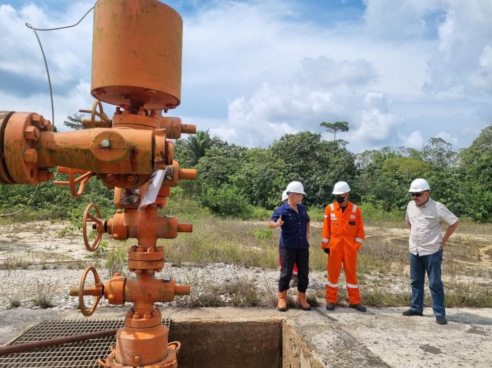
Samboja Field — a legacy from 1897, delivering today's energy.
A historic onshore field in Samboja, Kutai Kartanegara, East Kalimantan, with 300+ idle wells positioned for reactivation.
Samboja — Kutai Basin, PHSS working area.
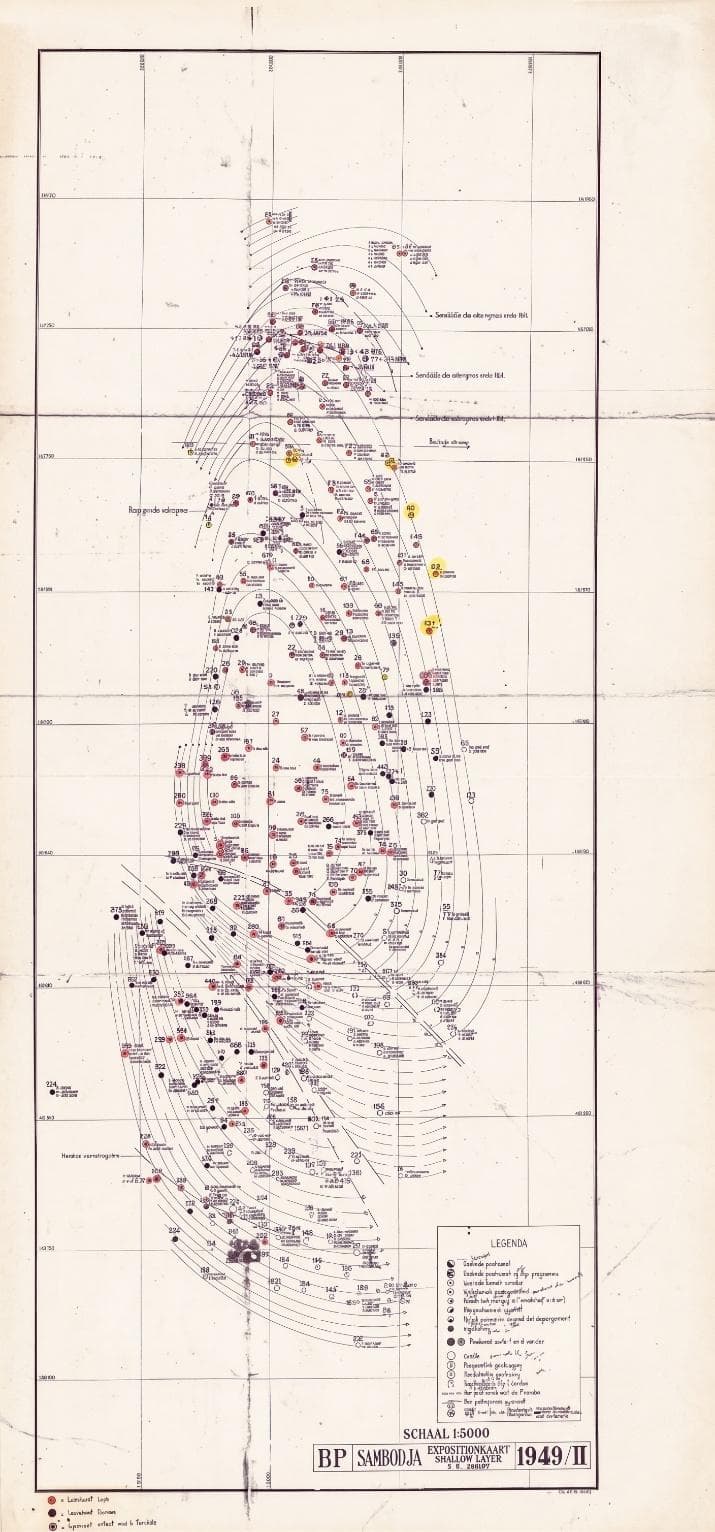
Samboja is a historic onshore oil & gas field first discovered in 1897. Geologically dominated by Miocene sandstone reservoirs with NE–SW trending anticlines. A deep-zone prospect below 800 m indicates additional shallow-marine reservoir potential.
Samboja operations sit within the PT Pertamina Hulu Indonesia (PHI) Regional 3 ecosystem, with involvement from Pertamina Hulu Sanga Sanga (PHSS), Pertamina EP (PEP) Sangasanga Field, and Pertamina Hulu Kalimantan Timur (PHKT).
Kutai Basin — Indonesia's largest Tertiary basin.
Formed by regional tectonic activity and the interaction of the Eurasian, Indo-Australian, and Pacific plates. The expansion of the Makassar Strait influenced sedimentary structure and depositional patterns. Formation began in the Middle Eocene, developing through flexure and basin uplift into the Oligocene.
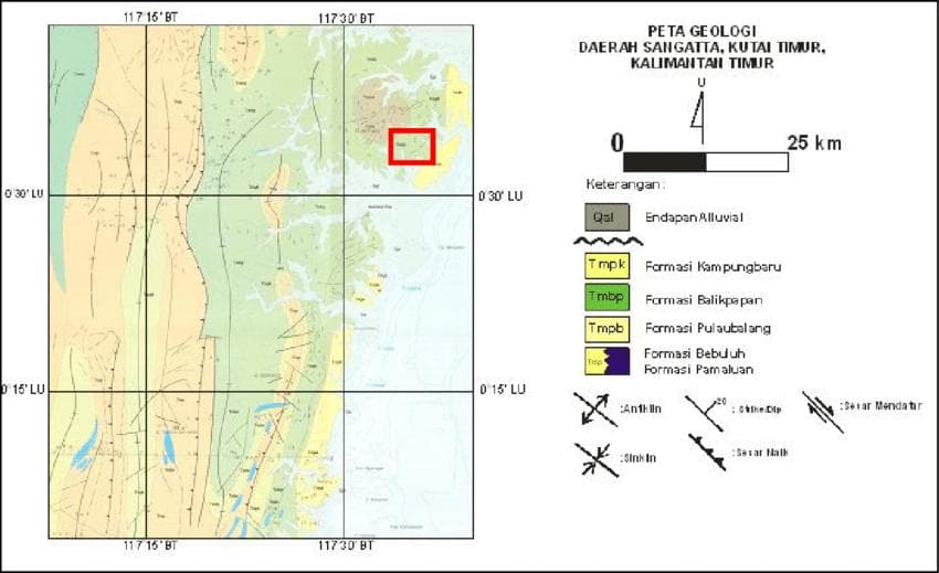
Implikasi: Variations in structure, facies, reservoir, seal, and hydrocarbon trapping are decisive factors in evaluating exploration, development, and idle well reactivation potential across the Kutai region.
Pamaluan Formation (Tomp)
Quartz sandstone with intercalations of mudstone, shale, limestone, and siltstone. Thickness ±2,000 m. Late Oligocene to early Miocene, neritic environment.
Kampungbaru Formation (Tpkb)
Quartz sandstone with mudstone, siltstone, shale, and coal intercalations. Delta-to-shallow-marine environment, thickness >500 m.
Balikpapan Formation (Tmbp)
Quartz sandstone with mudstone, limestone, 5–10 cm coal intercalations. Late lower to middle Miocene, thickness ±1,000–1,500 m.
Bebuluh Formation (Tmb)
Reef limestone with shale intercalations. Shallow marine environment, thickness ±300 m.
Pulau Balang Formation (Tmpb)
Greywacke, quartz sandstone, limestone, sandy tuffa, and coal. Interfingers with the Balikpapan Formation.
Operational support for reactivation.
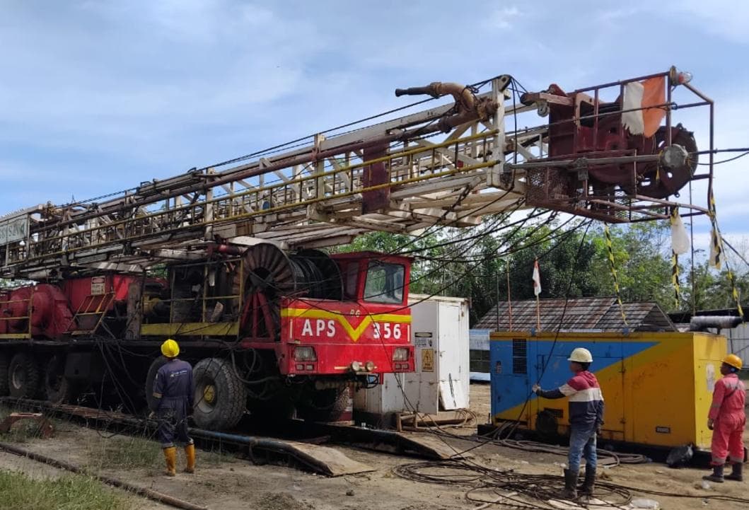
Double drum slickline unit
High-capacity slickline unit for well evaluation and intervention.
Hydraulic Power Pack — Zone 2
Hydraulic power pack rated for Zone 2 hazardous classification.
Pressure Control Equipment PCE 5,000 psi
Critical component for pressure control in well intervention.
Standard slickline tools
Complete toolkit for measurement, fishing, and light workover.
EMR / Memory gauge
Electronic recorder for downhole pressure and temperature data.
HIAB Crane 10 T · 30 days
Logistics and lifting support for equipment mobilization.